
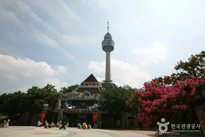
Short answer: Bongmu-dong is most useful as a flexible foothill decision: choose a park-and-lake pause, a local-history route or a deeper Palgongsan edge without pretending they are one short attraction. Current hours, prices, transport, facilities, events, weather, closures, safety notices and lodging availability are to be checked close to travel.
- A city-edge commitment decision that separates Bongmu Park, nearby local-history stops and the Palgongsan mountain approach, so travellers can keep shade, transport and walking effort under control.
- A Daegu group wants mountain atmosphere without committing everyone to a summit day, and needs a route that can survive heat, uneven bus timing, mixed stamina and a city-hotel return.
- Current hours, prices, transport, facilities, events, weather, closures, safety notices and lodging availability are to be checked close to travel.
- Choose one primary experience and one reversible fallback before you leave.
Treat Bongmu-dong as a foothill gateway, not a summit promise
DaeguTour describes Bongmu Park and nearby eastern Daegu attractions as a way to access the Palgongsan side of the city. The useful decision is not whether a map can draw a line from a park to a mountain. It is whether the group wants a low-effort local day, a cultural foothill sequence or a longer mountain commitment. Current hours, prices, transport, facilities, events, weather, closures, safety notices and lodging availability are to be checked close to travel.
A park-led visit protects flexibility. It gives a group a place to pause, observe local life and assess heat before deciding whether to continue. A mountain-edge route offers more landscape but requires a firmer transport and turnaround plan. Keep the options separate in the plan so one late bus or hot afternoon does not turn a pleasant city day into a rushed hike.
Choose one local texture before the mountain edge
The official Daegu tourism pages describe Bongmu Park, Bullo Traditional Market, Sutaegol Valley and Palgongsan attractions in different ways. They should not be treated as a single walk with guaranteed proximity. Decide whether the group wants water and shade, a market and local food, or a natural approach before adding another point. Current hours, prices, transport, facilities, events, weather, closures, safety notices and lodging availability are to be checked close to travel.
The trade-off is variety against transfer friction. A market stop gives food and ordinary neighbourhood context; a park stop gives breathing room; a foothill stop gives the strongest nature signal. Combining all three may sound efficient but can create waiting, heat exposure and repeated boarding. One main stop plus one reversible bonus is a better rule than a long list.
Use Palgongsan knowledge without overpromising a hike
DaeguTour presents Palgongsan as a large mountain area with temples, valleys, trails and multiple access points. That breadth is evidence of choice, not proof that a casual visitor can cross the mountain in one afternoon. Choose a named trailhead or facility, confirm its live status and make the turnaround the centre of the decision. Current hours, prices, transport, facilities, events, weather, closures, safety notices and lodging availability are to be checked close to travel.
The most common failure is planning by landmark names rather than by surface and transport. A foothill route can involve roads, bus stops, inclines and exposed waiting areas before any forest begins. Carry water, keep a map that works offline and avoid promising a cable car, valley or temple connection until the operator and transit pages have been checked.
Plan a mixed-weather eastern Daegu day
Bongmu-dong can be a useful test of the day’s conditions because the group can shorten the route before taking on more elevation. In rain, move the emphasis to a confirmed indoor or market chapter; in heat, start early and protect shaded pauses; in clear autumn air, reserve the longest outdoor section for the most comfortable hours. Current hours, prices, transport, facilities, events, weather, closures, safety notices and lodging availability are to be checked close to travel.
This is a route for people who value reversibility. The negative signal is that a foothill district may not offer the same density of cafés, toilets or late services as central Daegu. Do not assume a convenient fallback exists at every stop. Mark the return bus, taxi option and meal point before leaving the city centre.
Choose a base that respects the return
Central Daegu is usually the practical base when the group wants broad dining and rail choices after an eastern edge day. A quieter Dong-gu or mountain-side stay can reduce the next morning’s approach, but only if the actual last connection, food access and check-in plan are confirmed. Current hours, prices, transport, facilities, events, weather, closures, safety notices and lodging availability are to be checked close to travel.
Accommodation changes the route more than a small map distance suggests. A late return after heat or a long valley approach is easier when the group finishes near a known transit corridor. A mountain-adjacent room can be attractive for a sunrise start, yet the price may be fewer services and less flexible cancellation. Choose recovery over a postcard location when stamina is mixed.
Executable route decision table
| Route | Best for | Sequence | Trade-off |
|---|---|---|---|
| Bongmu park reset | First-time visitors and mixed stamina | Start at Bongmu Park; take a measured local pause; add one confirmed nearby attraction; return before the hottest period | Most reversible, but gives less mountain depth. |
| Market and foothill texture | Travellers who want daily life plus nature | Check Bullo-area access; eat or browse locally; move to one verified foothill point; keep a fixed return | Good contrast, but transfers and heat can consume the day. |
| Named Palgongsan edge | Walkers ready for a defined outdoor commitment | Choose one trailhead or facility; check status and surface; set a turnaround; return by the confirmed connection | More landscape, but less forgiving when transport changes. |
| Central Daegu fallback | Rain, extreme heat or delayed transit | Replace the edge section with a city museum, market or café chapter; keep the evening simple | Protects comfort, but loses the foothill atmosphere. |
Spring, summer, autumn and winter decisions
| Season | How to use the route | Seasonal trade-off |
|---|---|---|
| Spring | Use cooler mornings for the park and one foothill section, checking trail conditions after rain. | Green growth is inviting, but pollen, mud and weekend demand can slow the plan. |
| Summer | Start early, use shade and treat any valley or mountain section as optional. | Daegu heat and sudden storms make waiting and exposed roads expensive in comfort. |
| Autumn | Reserve the longest outdoor chapter for clear daylight and build in a conservative return. | Colour and comfortable air can bring crowds and make transport less flexible. |
| Winter | Prefer a shorter daylight route with a local meal and confirmed city return. | Clear air can be rewarding, but cold wind, bare surfaces and limited late services matter. |
Seasonal descriptions are planning signals rather than guarantees. Water, wind, light, events, access, crowds and facilities are to be checked close to travel. Daegu Bongmu-dong Foothill Route Decision: Park, Local History or a Palgongsan Edge Day? is updated 2026-09-13.
Positive evidence signals
- Bongmu-dong lets visitors test a Palgongsan day without automatically committing to a summit.
- Official Daegu tourism material describes multiple park, market, valley and mountain options.
- The route can combine local food or neighbourhood texture with a nature edge.
- A park-led plan creates a practical weather and stamina fallback.
- Central Daegu remains a workable base when the foothill route changes.
Limitations and negative evidence signals
- The attractions are spread across an eastern district; a map line is not a walking itinerary.
- Bus frequency, weekend routes, trail conditions and operator schedules can change.
- Summer heat makes exposed waiting and long transfers more costly than the distance suggests.
- A short foothill visit cannot substitute for a full Palgongsan mountain route.
- Late food, toilets and taxis may be thinner outside the central city.
Choose a route shape
| Route shape | How it works | Best match |
|---|---|---|
| The local reset | Use Bongmu Park as the main experience and let the mountain remain a visual edge. | Best for families and cautious first visits. |
| The two-texture day | Pair one market or local-history stop with one verified foothill location. | Best for travellers wanting ordinary Daegu and nature. |
| The defined mountain edge | Choose a named access point, set a turnaround and keep the city return visible. | Best for walkers who accept a firmer plan. |
Accommodation and return decision
| Stay shape | Why it helps | Cost or friction |
|---|---|---|
| Central Daegu base | Protects food choice, rail flexibility and an easy fallback after delays. | Adds a final ride after the eastern edge route. |
| Dong-gu foothill-side base | Can shorten an early start and reduce the first transfer. | Verify local services, late meals and the last bus or taxi. |
| Quiet family room | Makes heat recovery and an early night easier after an outdoor day. | May be farther from both the mountain and central attractions than expected. |
- Source 1: Official destination, city, tourism, heritage or operator information. Claims and live details are to be checked against the linked page close to travel.
- Source 2: Official destination, city, tourism, heritage or operator information. Claims and live details are to be checked against the linked page close to travel.
- Source 3: Official destination, city, tourism, heritage or operator information. Claims and live details are to be checked against the linked page close to travel.
- Source 4: Official destination, city, tourism, heritage or operator information. Claims and live details are to be checked against the linked page close to travel.
- Source 5: Official destination, city, tourism, heritage or operator information. Claims and live details are to be checked against the linked page close to travel.
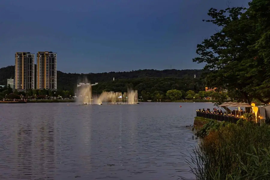
Image field
Plan the next action
Frequently asked questions
Is Bongmu-dong a mountain hike?
It can be the start of a foothill day, but Bongmu Park, local-history stops and deeper Palgongsan routes are different commitments. Choose one main level of effort. Current hours, prices, transport, facilities, events, weather, closures, safety notices and lodging availability are to be checked close to travel.
Can I visit without a car?
Official Daegu pages describe bus approaches for several attractions. Check the current route, weekend pattern, last departure and walking section before relying on public transport. Current hours, prices, transport, facilities, events, weather, closures, safety notices and lodging availability are to be checked close to travel.
What is the best family version?
Use Bongmu Park, one local meal and a short confirmed edge stop. Keep a central Daegu fallback if heat, rain or waiting becomes uncomfortable. Current hours, prices, transport, facilities, events, weather, closures, safety notices and lodging availability are to be checked close to travel.
Should I include Sutaegol Valley?
Only after checking current access, route conditions, weather and the group’s walking tolerance. A valley reference is not a promise of a simple city stroll. Current hours, prices, transport, facilities, events, weather, closures, safety notices and lodging availability are to be checked close to travel.
When is the foothill route most comfortable?
Spring and autumn often make outdoor planning easier, while summer needs an early start and winter needs daylight and warm layers. Live conditions still decide. Current hours, prices, transport, facilities, events, weather, closures, safety notices and lodging availability are to be checked close to travel.
Where should I stay?
Central Daegu is the flexible default; a Dong-gu base may help an early start. Compare the actual return and services rather than choosing by distance alone. Current hours, prices, transport, facilities, events, weather, closures, safety notices and lodging availability are to be checked close to travel.
KriNavi decision card
Best use of this page: Daegu Bongmu-dong Foothill Route Decision: Park, Local History or a Palgongsan Edge Day?
Core judgement: Choose a Daegu Bongmu-dong and Palgongsan foothill route by shade, local history, transit, effort and a realistic overnight base.
Sources checked in this page: Source 1 · Source 2 · Source 3 · Source 4
This card only reorganizes sources already listed by the page. Recheck live hours, prices, service, and restrictions for the travel date.